The Delta Conveyance Deep Dive video series continues with “Building the Tunnel Part Two”.
Published:
The Delta Conveyance Deep Dive video series continues with “Building the Tunnel Part Two”.
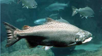
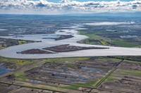
As planning and environmental review efforts continue to support DWR's determination of whether a single tunnel option to modernize Delta conveyance should be approved, an important component of the environmental review process is to assess environmental resource impacts within the Sacramento-San Joaquin Delta’s (Delta) estuary.
Lake Oroville Community Update for November 19, 2021.
Lake Oroville Community Update for November 12, 2021.
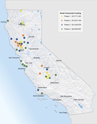
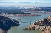
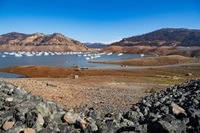
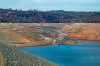
California and much of the Western United States is in the midst of an unprecedented drought intensified by climate change. The Department of Water Resources (DWR) is taking immediate action to support California’s small and rural communities now, while also preparing for the potential of a third dry year.
Lake Oroville Community Update for November 5, 2021.
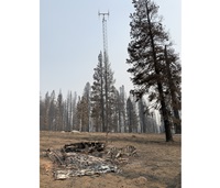
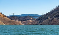
The impacts of California’s ongoing dry and warm years were seen this year with a historic wildfire season. Correspondingly, the risk of wildfire damage to water infrastructure is increasing, including risks of secondary impacts from burned area sediment entering waterbodies and affecting water treatment plant operations.
Read the Lake Oroville Community Update for October 29, 2021.
Lake Oroville Community Update for October 22, 2021.
Lake Oroville Community Update for October 15, 2021.