Modeling & Analysis
Conceptual Water System Modeling
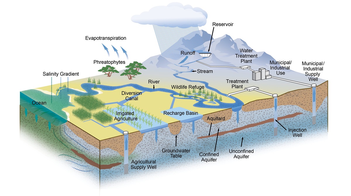
California has complex water management systems with natural features like mountain snowpack, lakes, rivers, and groundwater basins that are managed with engineered features like reservoirs, levees/flood walls, weirs, culverts, bypasses, and canals. Models represent the complex physical interactions between these features in a conceptual way. Models and other analytical tools help water managers make informed decisions about how best to manage water for people, farms, and the environment as well as to protect lives and properties from flooding.
We develop and maintain a number of state-of-the-art models and analytical tools that describe how water flows, flood risk, and water quality in California’s rivers, groundwater basins and the Sacramento-San Joaquin Delta, including current and future operations of State and federal projects.
Publications: Newsletters

Publications: Reports
- Methodology for Flow and Salinity Estimates Annual Progress Report 2025
- Methodology for Flow and Salinity Estimates Annual Progress Report 2024
- Final State Water Project Delivery Capability Report 2023
- Methodology for Flow and Salinity Estimates Annual Progress Report 2023
- Methodology for Flow and Salinity Estimates Annual Progress Report 2022
- Methodology for Flow and Salinity Estimates Annual Progress Report 2021
- Methodology for Flow and Salinity Estimates Annual Progress Report 2020
- Methodology for Flow and Salinity Estimates Annual Progress Report (Achived)
- CalSim 3.0 Main Report
- Estimates of Natural and Unimpaired Flows for the Central Valley of California: Water Years 1922-2014
- Frank’s Tract Futures (2020)
Publications: Journal Articles
- Optimum environmental conditions controlling prevalence of vibrio parahaemolyticus in marine environment (2023)
- Deep learning-based ensemble modeling of Vibrio parahaemolyticus concentration in marine environment (2022)
- Multidimensional Governing Equations of Matrix Flow Component of Subsurface Stormflow as Function of Bedrock Surface Geometry (2022)
- Novel Salinity Modeling using Deep Learning for the Sacramento-San Joaquin Delta of California (2022, Feature Paper)
- The Municipal Water Quality Investigations Program: A Retrospective Overview of the Program’s First Three Decades (2022)
- Suspended sediment concentration estimation in the Sacramento-San Joaquin Delta of California using Long Short-Term Memory Networks (2022)
- Salinity-constituent conversion in South Sacramento-San Joaquin Delta of California via machine learning (2022)
- Multi-Location Emulation of a Process-Based Salinity Model Using Machine Learning (2022, Feature Paper)
- Assessing Changes in 21st Century Mean and Extreme Climate of the Sacramento–San Joaquin Delta in California (2022, Editor’s Choice)
- Enhanced Artificial Neural Networks for Salinity Estimation and Forecasting in the Sacramento-San Joaquin Delta of California (2021)
- Apparent Seasonal Bias in Delta Outflow Estimates as Revealed in the Historical Salinity Record of the San Francisco Estuary: Implications for Delta Net Channel Depletion Estimates (2021)
- Projected Changes in Water Year Types and Hydrological Drought in California’s Central Valley in the 21st Century (2021)