
As California faces increasing weather extremes brought on by climate change, watershed-scale planning has become an essential strategy for developing adaptable solutions and more resilient communities.
Published:
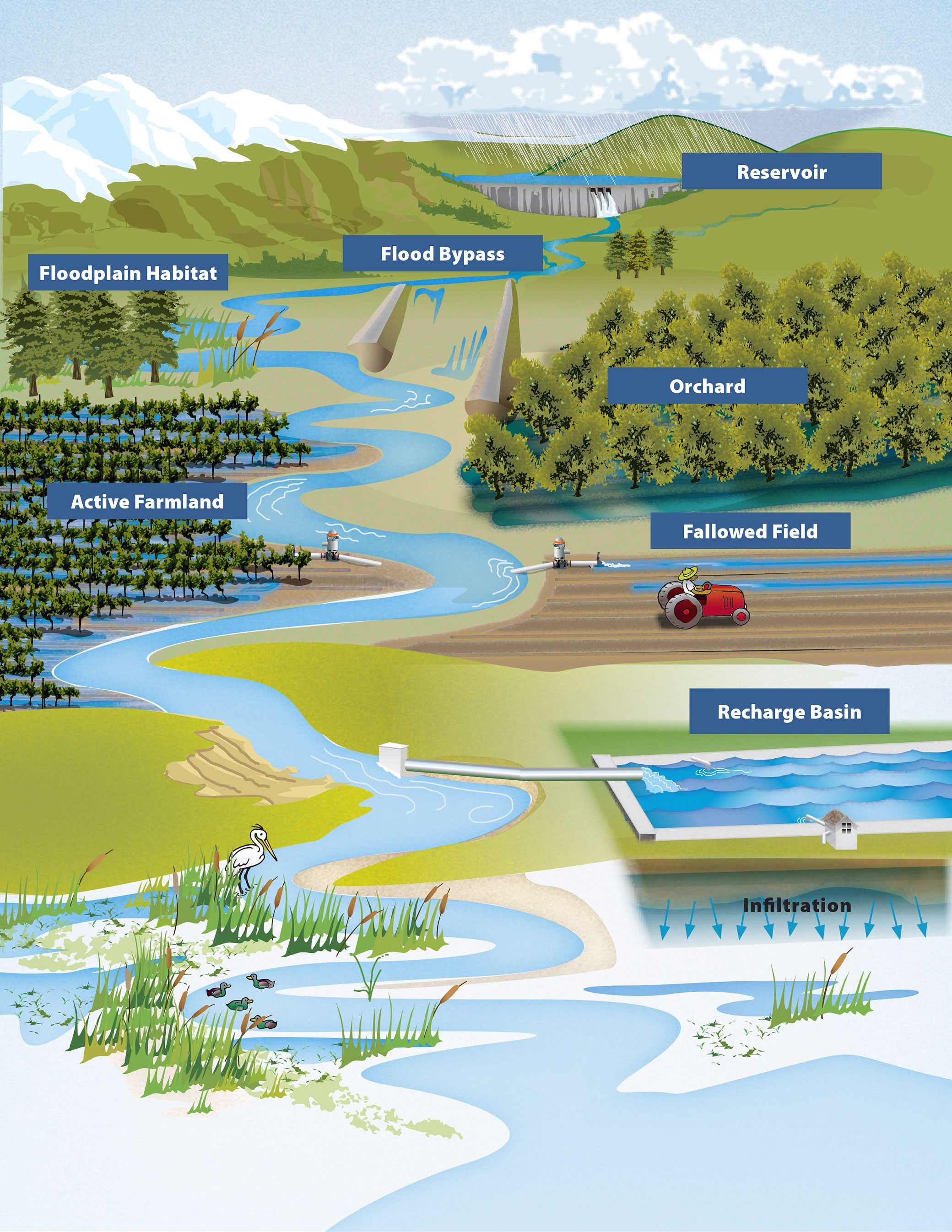
Flood-MAR is a water management strategy that redirects floodwater fromrainfall or snowmeltto agricultural lands, working landscapes, or managed natural lands including refuges, floodplains, and flood bypasses for groundwater recharge. Flood-MAR strategies can be implemented on a small-scale by individual landowners who divert floodwaterusing existing infrastructure or on a larger-scale through extensive detention/recharge areas and modernizing flood management infrastructure/operations.
Flood-MAR projects can provide broad benefits for Californians and the ecosystems of the state, including the following:water supply reliability, flood risk reduction,drought preparedness, aquifer replenishment, ecosystem enhancement, subsidence mitigation, water quality improvement, working landscapepreservation andstewardship,climate change adaptation, andrecreation and aesthetics.
As interest in Flood-MAR projects grows across the state, DWR is working with state, federal, Tribal, and local entities; academia; and landowners to build on existing knowledge, expand implementation, and strengthen Flood-MAR’s role in the state’s long-term water strategy.
Find answers to frequently asked questions about Flood-MAR in the FAQs.
DWR’s Watershed Studies explore two Flood-MAR strategies and examine how changing flood patterns, water supply, and ecosystem health can be jointly managed through coordinated recharge and reservoir operations. The Watershed Studies were conducted to see how they could help water managers reduce climate change risks and build resilience for communities, farms, and the environment.
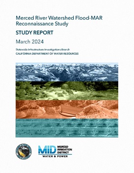
Merced River Watershed Flood-MAR Reconnaissance Study
To better understand climate vulnerabilities and how to address them, the California Department of Water Resources (DWR) conducted a three-year Merced study in partnership with Merced Irrigation District (MID) as a proof of concept to explore the effectiveness of Flood-MAR to concurrently reduce flood risk, improve water supply, and enhance ecosystems in the Merced River watershed, a tributary to the San Joaquin River. The Merced study is an exploratory watershed-scale analysis to develop and test analytical methods and models, assess climate change vulnerability, and evaluate adaptation strategies meeting multiple benefits that achieve these shared objectives:
Following is the Merced River Watershed Flood-MAR Reconnaissance Study Report and supporting technical information records (TIR) that explain the development as well as the results of the study:
 TheFlood-MAR Research and Data Development Plan (R&DD Plan) was created by a team of subject matter experts across 13 research themes who identified the research, data, guidance, and tools necessary to support and expand the implementation Flood-MAR projects. There has been a lot of progress since the plan was developed, and an evaluation outlines the advances made on its 39 key actions while also pointing to dozens of resources created to support broader use of Flood-MAR.
Theme-specific Actions and Documentation are available by request to FloodMAR@water.ca.gov.
Coordinating Flood and Groundwater Management Brochure
Learn more about how Flood-MAR can reduce flood risk, boost groundwater recharge, and support climate adaptation by strengthening coordination between flood and groundwater management.
Explore how large-scale Flood-MAR implementation can help rehabilitate and modernize California’s water and flood infrastructure.
The following websites provide additional information and resources on the benefits and issues of using flood waters to recharge groundwater basins.
As California faces increasing weather extremes brought on by climate change, watershed-scale planning has become an essential strategy for developing adaptable solutions and more resilient communities.

California is taking a new, data-driven approach to capturing floodwaters for groundwater recharge. DWR, in coordination with GEI Consultants, has released the Central Valley Flood-MAR Dashboard for public testing, allowing water managers across the San Joaquin and Sacramento Valleys the opportunity to explore the tool and offer feedback.

After a dry start, a series of late-December storms brought enough rain to swell the Sacramento River and overtop the Fremont Weir.
On September 16, 2026, a fellowship made from the California Department of Water Resources’ Division of Flood Operations and GEI environmental consultants embarked on a three-day mission within Desolation Wilderness to renovate the existing snow pillow station, Lake Lois, with a new Hinge Fold Tilt-Pole.

DWR is calling on all Californians to understand the risk posed by flooding and how to respond during an emergency during this California Flood Preparedness Week.

The California Department of Water Resources (DWR) is committed to building climate resilience in the Sacramento-San Joaquin Delta.

A groundbreaking flood mapping study completed by the California Department of Water Resources (DWR) shows that climate extremes will significantly increase major flooding in the coming decades, highlighting the urgent need for stronger state and regional flood management efforts to prepare for and address these rising risks and more frequent flood ...


Since the 1950s, California’s salmon populations have dwindled due to lost habitat from a combination of factors, including human-made barriers such as dams, altered river flows, and climate change.