Modeling
DWR’s Modeling Support Branch of the Bay-Delta Office provides ongoing support for the Integrated Water Flow Model (IWFM) code. IWFM is a water resources management and planning model that simulates groundwater, surface water, stream-groundwater interaction, and other components of the hydrologic system.

California Central Valley Groundwater-Surface Water Simulation Model (C2VSim)
C2VSim is an integrated numerical model that simulates water movement through the linked land surface, groundwater and surface water flow systems in California's Central Valley using the IWFM modeling platform.
Current Release of the Fine-Grid Version

Sacramento Valley Groundwater-Surface Water Simulation Model (SVSim)
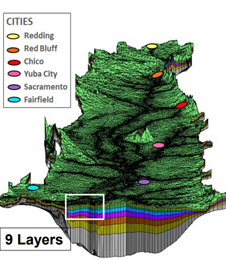
SVSim is a new model of the Sacramento Valley using the IWFM code and based on the C2VSim-Fine Grid dataset. This model is being developed to support more detailed analysis of streamflow depletion due to groundwater substitution transfers as well as support the implementation of SGMA. SVSim will have an updated representation of the hydrogeologic conceptual model and aquifer parameters based on an extensive lithologic texture analysis. It will also have a more refined (smaller) horizontal grid along major waterways and more discretized vertical layering. A beta version of SVSim was posted on April 30, 2020. The calibrated SVSim Version 1.0 model including complete documentation is now available.
SVSim Technical Memos:
- SVSim TM-1A: Modeling Approach for C2VSim Enhancement
- SVSim TM-1B: Development of Hydrogeologic Conceptual Model and Aquifer Parameters
- SVSim TM-2: Model Grid Development
- SVSim TM-3: Model Input Data Development
- SVSim TM-4: Calibration and Sensitivity Analysis
SVSim Version 1.0 and the Beta Release, TM's, Fact Sheet, and the Sacramento Valley Texture Data can be accessed and commented on at the links below:
