Lake Oroville Update - January 26, 2024
A drone view of water levels at the Bidwell Bar Bridge located at Lake Oroville in Butte County, California. Photo taken October 2, 2023.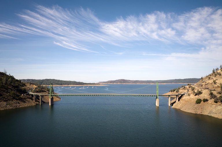
Oroville Recreation Advisory Committee
The Oroville Recreation Advisory Committee (ORAC) will hold a meeting on Friday, Feb. 2 at 10 a.m. at the Southside Oroville Community Center located at 2959 Lower Wyandotte Road, Oroville, CA, 95966.
ORAC was established by the Federal Energy Regulatory Commission (FERC) to review and provide recreation plan recommendations for Oroville Facilities owned by the Department of Water Resources (DWR). The 13-member committee is made up of representatives from state and local government, recreation groups, and business and community organizations.
Brood Ponds Support Native Wildlife
Within the Oroville-Thermalito Complex, DWR maintains several areas that preserve and enhance wildlife habitat. Encompassed within the Thermalito Afterbay’s 17 miles of shoreline and 4,300 surface acres of water are numerous brood ponds that provide prime habitat and breeding areas for waterfowl and giant garter snakes, a protected species. While water levels at the Afterbay may fluctuate based on agriculture and hydropower operations, DWR ensures brood pond habitats remain stable. A flap gate outlet system permits water to flow into brood pond areas, raising water levels, while preventing water from being released and maintaining a stable elevation for waterfowl nests and giant garter snakes. These measures ensure these species continue to thrive, upholding DWR’s commitment to protect, restore, and enhance the natural and human environments.
Snow Goose Festival
Celebrate one of the greatest migratory bird pathways in the world at the Snow Goose Festival of the Pacific Flyway happening Jan. 25 to Jan. 28. The festival hosts a variety of activities throughout the four-day event, including guided field trips to view the waterfowl, raptors and Snow Geese that migrate through the Northern Sacramento Valley during the winter months.
DWR’s Lake Oroville Visitor Center Guides will host a free educational booth featuring kids’ activities between 9 a.m. and 3 p.m. on Saturday, Jan. 27 and Sunday, Jan. 28 at the Patrick Ranch Museum in Chico. Join festival attendees with visits to the Thermalito Forebay and Afterbay, and Oroville Wildlife Area offering possible sightings of rough-legged hawk, ferruginous hawk, merlin, bald eagle, golden eagle, red-tailed hawk, burrowing owl, ducks, grebes, and other deep-water birds. Check out the Snow Goose Festival website for more details about activities, an avian art exhibit, and guided field trips during the four-day event.
Midwinter Bald Eagle Survey
Environmental scientists from DWR participated in the National Midwinter Bald Eagle Survey on Jan. 5 and Jan. 8. This nationwide effort, coordinated by the U.S. Army Corps of Engineers, aims to determine bald eagle distribution and identify areas of important winter habitats. This year’s official count was 77 bald eagles for the Lake Oroville Winter Roost and 16 at the Thermalito Complex.
Lake Oroville and the Sacramento Valley area provide an ideal habitat for bald eagles. Fish and waterfowl are the eagle’s main food source during this time of the year and large water bodies like Lake Oroville provide a wide variety of fish and the nearby wetlands and flooded rice fields provide an abundant supply of waterfowl for eagle foraging. The many trees and snags (tall dead trees) near water areas provide prime roosting locations for the bald eagles that migrate to and through the area during the winter months.
Oroville Recreation
DWR, State Parks, and the California Department of Fish and Wildlife (CDFW) maintain over 92 miles of trails in the Oroville area. An interactive map of recreation facilities, including open trails and their permitted uses (hike, bike, horse, multi), is available on DWR’s Lake Oroville Recreation webpage. A paper trail map is available at various locations, including most entrance kiosks and the Lake Oroville Visitor Center.
The Lake Oroville Visitor Center is open daily from 9 a.m. to 5 p.m. Staffed by knowledgeable guides, the Visitor Center features interpretive displays on Oroville Dam, area geology, wildlife and habitat, hydroelectric power, and cultural and historical artifacts. View videos in the theater about the construction of Oroville Dam, walk or hike along nearby trails, and visit the 47-foot-tall observation tower that provides unsurpassed panoramic views of surrounding areas. Free guided tours for school and community groups are available by reservation. Parking and admission to the Visitor Center are free.
Lake Oroville is one of the State Water Project’s premier recreational destinations and one of California’s best fishing spots. The lake provides both warm-water and cold-water fisheries. Below the Oroville Dam, the Thermalito Forebay, Thermalito Afterbay and the Feather River offer additional excellent fishing opportunities. The marinas at Bidwell Canyon and Lime Saddle are open daily and provide a variety of services including a convenience store, gas, and boat rentals.
Upstream migrating fish totals between Sept. 11, 2023 and Jan. 20, 2024 are:
- Chinook salmon: 31,153
- Steelhead: 1,147
Current Lake Operations
Lake Oroville is at 838 feet elevation and storage is approximately 2.65 million acre-feet (MAF), which is 75 percent of its total capacity and 131 percent of the historical average.
Feather River flows remain at 650 cubic feet per second (cfs) through the City of Oroville with 1,100 cfs being released from the Thermalito Afterbay River Outlet (Outlet) for a total Feather River release of 1,750 cfs downstream. DWR continues to assess releases to the Feather River daily.
Winter storms have caused Lake Oroville’s elevation to rise above the level of the spillway’s main gates. While the gates are closed, water may still be seen on the main spillway outlet as the seals on the eight radial gates are not designed to be watertight. The seals do not play a role in the structural integrity of the gates, which continue to operate as intended. DWR periodically maintains and adjusts the seals during low-reservoir conditions to improve their sealing capability.
Visitors to Oroville Dam may also notice minor amounts of water flowing from drains built into the emergency spillway, which is normal and expected with the emergency spillway design. The dam and emergency spillway continue to operate as intended.
The public can track precipitation, snow, reservoir levels, and more at the California Data Exchange Center. The Lake Oroville gage station is identified as “ORO.”
All data as of midnight 1/25/2024.
###
Know someone who would like to receive Community Updates? They can email their request to oroville@water.ca.gov.