Lake Oroville Community Update - January 19, 2024
A bald eagle flies near the Lake Oroville main spillway site in Butte County, California. Photo taken April 26, 2018.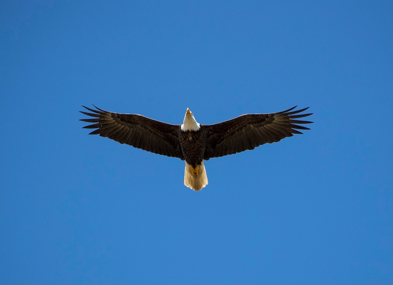
Midwinter Bald Eagle Survey
Environmental scientists from the Department of Water Resources (DWR) participated in the National Midwinter Bald Eagle Survey on Jan. 5 and Jan. 8. This nationwide effort, coordinated by the U.S. Army Corps of Engineers, aims to determine bald eagle distribution and identify areas of important winter habitats. This year’s official count was 77 bald eagles for the Lake Oroville Winter Roost and 16 at the Thermalito Complex.
Lake Oroville and the Sacramento Valley area provide an ideal habitat for bald eagles. Fish and waterfowl are the eagle’s main food source during this time of the year and large water bodies like Lake Oroville provide a wide variety of fish, and the nearby wetlands and flooded rice fields provide an abundant supply of waterfowl for eagle foraging. The many trees and snags (tall dead trees) near water areas provide prime roosting locations for the bald eagles that migrate to and through the area during the winter months.
Snow Goose Festival
Celebrate one of the greatest migratory bird pathways in the world at the Snow Goose Festival of the Pacific Flyway happening Jan. 25 to Jan. 28. The festival hosts a variety of activities throughout the four-day event, including guided field trips to view the waterfowl, raptors, and Snow Geese that migrate through the Northern Sacramento Valley during the winter months.
DWR’s Lake Oroville Visitor Center Guides will host a free educational booth featuring kids’ activities between 9 a.m. and 4 p.m. Saturday, Jan. 27 and Sunday, Jan. 28 at the Patrick Ranch Museum in Durham. Join festival attendees with visits to the Thermalito Forebay and Afterbay and Oroville Wildlife Area offering possible sightings of Rough-legged Hawk, Ferruginous Hawk, Merlin, Bald and Golden Eagle, Red-tailed Hawk, Burrowing Owl, ducks, grebes, and other deep-water birds. Check out the Snow Goose Festival website for more details about activities, an avian art exhibit, and guided field trips during the four-day event.
Main Spillway Gate Testing
DWR will conduct routine testing on Oroville Dam’s main spillway gate hoist system on Wednesday, Jan. 24 between 10:30 a.m. and noon. During testing, two main spillway gates will be lifted one foot, releasing approximately 800 cubic feet per second of water down the spillway chute. The gates will remain open for approximately 15 minutes before being closed. Due to the minimal amount of water being released, water will appear to trickle from the chute. DWR will sound Oroville Dam’s alarm prior to spillway releases and gate testing. Oroville Dam’s eight main spillway radial gates were also inspected and tested in Nov. 2023.
Recent storms have caused Lake Oroville’s elevation to rise above the level of the spillway’s main gates. While the gates are closed, water may still be seen on the main spillway outlet as the seals on the eight radial gates are not designed to be watertight. The seals do not play a role in the structural integrity of the gates, which continue to operate as intended. DWR periodically maintains and adjusts the seals during low-reservoir conditions to improve their sealing capability.
Exercising at Oroville Dam
While Oroville Dam plays a critical role in providing flood protection to downstream communities, it may not also come to mind as a prime location for physical fitness. However, a 1.3-mile paved road and separated two-lane multi-use path runs the length of the dam’s crest, offering an opportunity for exercise while enjoying scenic views of both Lake Oroville and the valley. Free parking is available on either side of the dam’s crest with restroom facilities located at the intersection of Canyon Drive and Oroville Dam Crest Road. For early birds or late-night fitness enthusiasts, the dam crest path is fully lit, making it a great location for free outdoor recreation during the shorter daylight hours of the winter months.
Those looking for additional hiking or biking opportunities may use the Oroville Dam Crest trail to connect to an additional 92 miles of trails throughout the Oroville area. An interactive map of recreation facilities, including open trails and their permitted uses (hike, bike, horse, multi), is available on DWR’s Lake Oroville Recreation webpage. A paper trail map is available at various locations, including most entrance kiosks and the Lake Oroville Visitor Center.
Oroville Recreation
The Lake Oroville Visitor Center is open daily from 9 a.m. to 5 p.m. Staffed by knowledgeable guides, the Visitor Center features interpretive displays on Oroville Dam, area geology, wildlife and habitat, hydroelectric power, and cultural and historical artifacts. View videos in the theater about the construction of Oroville Dam, walk or hike along nearby trails, and visit the 47-foot-tall observation tower that provides unsurpassed panoramic views of surrounding areas. Free guided tours for school and community groups are available by reservation. Parking and admission to the Visitor Center are free.
Lake Oroville is one of the State Water Project’s premier recreational destinations and one of California’s best fishing spots. The lake provides both warm-water and cold-water fisheries. Below the Oroville Dam, the Thermalito Forebay, Thermalito Afterbay and the Feather River offer additional excellent fishing opportunities. The marinas at Bidwell Canyon and Lime Saddle are open daily and provide a variety of services including a convenience store, gas, and boat rentals.
Upstream migrating fish totals between Sept. 11, 2023 and Jan. 13, 2024 are:
- Chinook salmon: 31,113
- Steelhead: 1006
Current Lake Operations
Lake Oroville is at 825 feet elevation and storage is approximately 2.49 million acre-feet (MAF), which is 70 percent of its total capacity and 126 percent of the historical average.
Feather River flows remain at 650 cubic feet per second (cfs) through the City of Oroville with 1,100 cfs being released from the Thermalito Afterbay River Outlet (Outlet) for a total Feather River release of 1,750 cfs downstream. DWR continues to assess releases to the Feather River daily.
Visitors to Oroville Dam may also notice minor amounts of water flowing from drains built into the emergency spillway, which is normal and expected with the emergency spillway design. The dam and emergency spillway continue to operate as intended.
The public can track precipitation, snow, reservoir levels, and more at the California Data Exchange Center. The Lake Oroville gage station is identified as “ORO.”
All data as of midnight 1/18/2024.