Lake Oroville Community Update - October 6, 2023
A drone view of water levels at the Bidwell Canyon Boat Ramp located at Lake Oroville in Butte County, California. Photo taken March 8, 2023.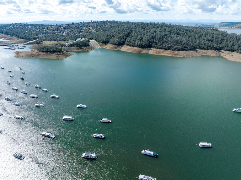
Feather River Floating Classrooms
Spend time on the beautiful Feather River this fall and join Department of Water Resources (DWR) scientists for educational floats each Saturday through Nov. 11. Rafting trips will float through Feather River spawning habitat while DWR scientists provide information on Chinook salmon conservation efforts, ongoing and planned research, and restoration and monitoring projects.
Each Saturday will have three floating classroom sessions with limited seats. Weekend sessions support free floating classroom events for local schools. Reserve your Floating Classroom Tour Tickets on Eventbrite.
Vegetation Management Activities
DWR and CAL FIRE have resumed vegetation management activities in the Loafer Creek Recreation Area. CAL FIRE hand crews and heavy equipment operators will be working throughout Loafer Creek and along HWY 162 (Oro Quincy Highway) for the next several months. Smoke from pile burning activities will be visible in the Oroville area. The goal of this project is to remove overgrown ladder fuels, dead and dying vegetation, and minimize ground fuels to create a more wildfire resilient landscape.
DWR’s Fuel Load Management Plan works to reduce wildfire risk, increase public safety, and enhance forest health around the Lake Oroville area. Ongoing vegetation management of this critical area remains a high priority for DWR and its partners at CAL FIRE, Butte County Fire Department, Butte County Sheriff’s Office, California Conservation Corps (CCC), California Department of Parks and Recreation (State Parks), and the Butte County Fire Safe Council. Vegetation management activities are ramping up for the season and will continue through Spring 2024 as weather conditions permit and crews are available.
California Water Plan 2023
From severe, multi-year droughts to sudden flooding, California is experiencing the intensifying impacts of climate change. To better prepare and plan for a future with climate extremes, DWR has released the Public Review Draft of California Water Plan Update 2023.
For decades, the California Water Plan has served and evolved as a strategic blueprint for managing and developing the state's water resources. This comprehensive plan is meant to guide water managers, including water districts, cities, counties, and Tribal communities. Every five years the California Water Plan is updated, as mandated by the State Water Code, to reflect current water conditions and State government priorities. These updates are shaped by various factors, including the Water Resilience Portfolio, input from interested parties, state needs, and the Governor's commitment to climate action, as demonstrated in California's Water Supply Strategy: Adapting to a Hotter, Drier Future.
Public comments on the Draft California Water Plan Update 2023 are being accepted through Oct. 19, 2023. Comments may be submitted through an online form or to CWPCOM@water.ca.gov.
New Spillway Day Use Area Hours
With the end of summer and shorter daylight hours approaching, the Spillway Day Use Area has reduced hours. The Spillway Day Use Area and Boat Ramp is now open daily from 6 a.m. to 8 p.m. These reduced hours will remain in effect through April 30, 2024. Vehicles may remain in the parking lot overnight but will be prohibited from exiting.
All vehicles and trailers heading to the Spillway Day Use Area are subject to inspection by the California Highway Patrol (CHP) for security purposes. There are three other boat ramps at Lake Oroville that are open 24 hours a day and do not entail CHP inspections: Bidwell Canyon, Loafer Point, and Lime Saddle.
Oroville Recreation
DWR biologists are using the Feather River Fish Monitoring Station to determine abundance, run timing, and origin (hatchery or natural) of steelhead and Chinook salmon populations. This information will improve management of these important fish populations. Upstream migrating fish totals between Sept. 11 and Sept. 24:
- Chinook salmon: 4,053
- Steelhead: 148
DWR, State Parks, and the Department of Fish and Wildlife maintain over 92 miles of trails in the Oroville area. An interactive map of recreation facilities, including open boat ramps, and their permitted uses (hike, bike, horse, multi) is available on DWR’s Lake Oroville Recreation webpage. A paper trail map is available at various locations, including most entrance kiosks and the Lake Oroville Visitor Center. The marinas at Bidwell Canyon and Lime Saddle are open daily and provide a variety of services including a convenience store, gas, and boat rentals.
The Lake Oroville Visitor Center is open seven days a week from 9 a.m. to 5 p.m. Staffed by knowledgeable guides, the Visitor Center features interpretive displays on Oroville Dam, area geology, wildlife and habitat, hydroelectric power, and cultural and historical artifacts. View videos in the theater about the construction of Oroville Dam, walk or hike along nearby trails, and visit the 47-foot-tall observation tower that provides unsurpassed panoramic views of surrounding areas. Free guided tours for school and community groups are available by reservation. Parking and admission to the Visitor Center are free.
Current Lake Operations
Lake Oroville is at 831 feet elevation and storage is approximately 2.56 million acre-feet (MAF), which is 72 percent of its total capacity and 135 percent of the historical average.
Feather River releases are being reduced to 4,000 cubic feet per second (cfs) through Tuesday, Oct. 10. Flows through the City of Oroville remain at 650 cfs and releases from the Thermalito Afterbay Outlet (Outlet) are being reduced to 3,350 cfs for a total of 4,000 cfs downstream of the Outlet. Further reductions are currently anticipated next week. DWR continues to assess releases to the Feather River daily.
DWR’s Water Operations division has begun adjusting reservoir levels in accordance with the U.S. Army Corps of Engineers Water Control Manual. This is done each year in preparation for the winter season to provide flood control protection to downstream communities and obtain additional space in the lake for increased storm runoff. Additionally, DWR’s Water Operations division monitors forecasts closely to predict incoming storm impacts and determine whether to release additional water to account for higher estimated inflows.
Visitors to Oroville Dam may also notice minor amounts of water flowing from drains built into the emergency spillway, which is normal and expected with the emergency spillway design. The dam and emergency spillway continue to operate as intended.
The public can track precipitation, snow, reservoir levels, and more at the California Data Exchange Center. The Lake Oroville gage station is identified as “ORO.”
All data as of midnight 10/05/2023.