Lake Oroville Community Update - October 27, 2023
A drone view of water levels at the Bidwell Canyon Marina located at Lake Oroville in Butte County, California. Photo taken October 2, 2023.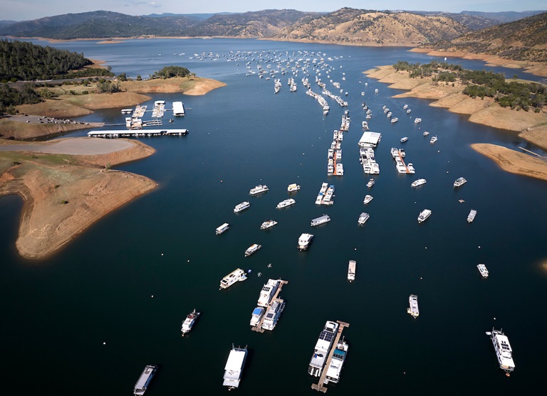
Oroville Recreation Advisory Committee
The Oroville Recreation Advisory Committee (ORAC) will hold a public meeting on Friday, Nov. 3 at 10 a.m. at the Southside Oroville Community Center located at 2959 Lower Wyandotte Road, Oroville, CA, 95966.
ORAC was established by the Federal Energy Regulatory Commission (FERC) to review and provide recreation plan recommendations for Oroville Facilities owned by the Department of Water Resources (DWR). The 13-member committee is made up of representatives from state and local government, recreation groups, and business and community organizations.
Flood Preparedness Week
This week is Flood Preparedness Week, which runs from Oct. 21 to Oct. 28. More than seven million California residents are at risk of flooding, and many don’t realize it. Flooding can occur throughout the state, from rural to urban areas, in valley and desert communities, in mountain regions, and along the coast. Every California county has received a flood-related emergency declaration in the past 20 years. Flooding can also happen at any time of year and can even occur during drought years.
Communities that are downslope of recent wildfires are especially prone to flash floods and debris slides, as landscapes impacted by wildfires can take up to five years to recover. In recent years, DWR, as a member of the Feather River Watershed Working Group (FRWWG), helped address wildfire impacts in the watershed surrounding Lake Oroville. Following the North Complex and Dixie Fires, the FRWWG installed erosion control measures to help prevent toxic ash and burned materials from entering the waterways that supply Lake Oroville. This included debris flow measurement, cleanup, and additional water sampling activities.
To prepare for flooding, all Californians should follow three basic steps:
- Be aware of your risk – know whether your home is downslope of a burn area or in a floodplain; pay attention to weather forecasts; listen to local authorities.
- Be prepared – always have an emergency evacuation kit ready; be prepared to evacuate early; have a plan for where you will go in an emergency and what to do with your pets.
- Take action – subscribe to your local emergency providers to get updated information. Visit the National Weather Service webpage to get updated weather information for your community. If local authorities issue an evacuation order, do not delay, follow local guidelines for evacuation and never attempt to drive through a flooded roadway.
For more information on finding your flood risk visit https://myhazards.caloes.ca.gov/.
For information on obtaining flood insurance visit https://www.floodsmart.gov/.
For information on how you can prepare your household for flood emergencies, visit https://www.ready.gov/kit.
Brad Freeman Trail Improvements
DWR has begun construction work to improve a 1.5-mile section of the Brad Freeman Trail between Cherokee Road and the Highway 70 Garden Drive overpass. Planned improvements include upgrading the existing gravel/dirt trail to include an 8-foot-wide asphalt path for cyclists and a 4-foot-wide decomposed granite path for pedestrians. Existing entrance bollards will also be replaced with wider, accessible box gates.
The improvement project is supported by a Land and Water Conservation Fund grant through the National Park Service, with remaining funding for the $700,000 project provided by DWR. During construction, portions of the Brad Freeman Trail may be closed intermittently for paving and grading work. Trail improvements are being completed in phases and work may be suspended during the winter months depending on weather conditions. Project completion is expected by June 2025.
Vegetation Management Activities
DWR has been awarded Hazard Mitigation Grant Program (HMGP) funds totaling $900,000 from the Federal Emergency Management Agency (FEMA) to complete a 305-acre hazardous fuels reduction project in the Lake Oroville area. Fuel reduction locations include DWR property along Oro Dam Blvd. East, the Bidwell Canyon/Kelly Ridge area, and the Loafer Creek State Recreation Area.
This multi-year project will reduce hazardous fuels by thinning vegetation using hand and mechanical methods accompanied by chipping. This project reduces the risk of a catastrophic wildfire by improving defensible space around infrastructure, roads, and residential areas. By proactively reducing ground fuels, thinning overgrown vegetation, and removing dead and dying vegetation, firefighters have a better chance at suppressing a wildfire.
HMGP work began this week and will continue over the next three years. This work may cause intermittent trail closures within project areas. Recreational trail users should be cautious when entering work areas and obey all posted trail signage.
In addition to HMGP activities, DWR and CAL FIRE have resumed vegetation management activities in the Loafer Creek Recreation Area. Starting the week of Oct. 30, CAL FIRE hand crews and heavy equipment operators will be performing prescribed burns throughout Loafer Creek and along HWY 162 (Oro Quincy Highway). Smoke from pile burning activities will be visible in the Oroville area for the next several months.
DWR’s Fuel Load Management Plan works to reduce wildfire risk, increase public safety, and enhance forest health around the Lake Oroville area. Ongoing vegetation management of this critical area remains a high priority for DWR and its partners at CAL FIRE, Butte County Fire Department, Butte County Sheriff’s Office, California Conservation Corps (CCC), California Department of Parks and Recreation (State Parks), and the Butte County Fire Safe Council.
Oroville Recreation
DWR biologists are using the Feather River Fish Monitoring Station to determine abundance, run timing, and origin (hatchery or natural) of steelhead and Chinook salmon populations. This information will improve the management of these important fish populations. Upstream migrating fish totals between Sept. 11 and Oct. 19 are:
- Chinook salmon: 16,031
- Steelhead: 440
DWR, State Parks, and the Department of Fish and Wildlife maintain over 92 miles of trails in the Oroville area. An interactive map of recreation facilities, including open boat ramps, and their permitted uses (hike, bike, horse, multi) is available on DWR’s Lake Oroville Recreation webpage. A paper trail map is available at various locations, including most entrance kiosks and the Lake Oroville Visitor Center. The marinas at Bidwell Canyon and Lime Saddle are open daily and provide a variety of services including a convenience store, gas, and boat rentals.
The Lake Oroville Visitor Center is open seven days a week from 9 a.m. to 5 p.m. Staffed by knowledgeable guides, the Visitor Center features interpretive displays on Oroville Dam, area geology, wildlife and habitat, hydroelectric power, and cultural and historical artifacts. View videos in the theater about the construction of Oroville Dam, walk or hike along nearby trails, and visit the 47-foot-tall observation tower that provides unsurpassed panoramic views of surrounding areas. Free guided tours for school and community groups are available by reservation. Parking and admission to the Visitor Center are free.
Current Lake Operations
Lake Oroville is at 822 feet elevation and storage is approximately 2.45 million acre-feet (MAF), which is 69 percent of its total capacity and 134 percent of the historical average.
Feather River flows remain at 650 cubic feet per second (cfs) through the City of Oroville with 1,800 cfs being released from the Thermalito Afterbay River Outlet (Outlet) for a total of 2,450 cfs downstream of the Outlet. Outlet releases are scheduled to be reduced starting Sunday, Oct. 29, with Outlet releases reduced to 1,100 cfs by Nov. 1 for a total flow below the Outlet of 1,750 cfs. DWR continues to assess releases to the Feather River daily.
Visitors to Oroville Dam may also notice minor amounts of water flowing from drains built into the emergency spillway, which is normal and expected with the emergency spillway design. The dam and emergency spillway continue to operate as intended.
The public can track precipitation, snow, reservoir levels, and more at the California Data Exchange Center. The Lake Oroville gage station is identified as “ORO.”
All data as of midnight 10/26/2023.