Lake Oroville Community Update - October 20, 2023
A drone view of water levels at the Oroville Dam located at Lake Oroville in Butte County, California. Photo taken October 2, 2023.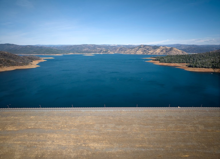
Brad Freeman Trail Improvements
The Department of Water Resources (DWR) has begun construction work to improve a 1.5-mile section of the Brad Freeman Trail between Cherokee Road and the Highway 70 Garden Drive overpass. Planned improvements include upgrading the existing gravel/dirt trail to include an 8-foot-wide asphalt path for cyclists and a 4-foot-wide decomposed granite path for pedestrians. Existing entrance bollards will also be replaced with wider, accessible box gates.
The improvement project is supported by a Land and Water Conservation Fund grant through the National Park Service, with remaining funding for the $700,000 project provided by DWR. During construction, portions of the Brad Freeman Trail may be closed intermittently for paving and grading work. Trail improvements are being completed in phases and work may be suspended during the winter months depending on weather conditions. Project completion is expected by June 2025.
Vegetation Management Activities
DWR has been awarded Hazard Mitigation Grant Program (HMGP) funds totaling $900,000 from the Federal Emergency Management Agency (FEMA) to complete a 305-acre hazardous fuels reduction project in the Lake Oroville area. Fuel reduction locations include DWR property along Oro Dam Blvd. East, the Bidwell Canyon/Kelly Ridge area, and the Loafer Creek State Recreation Area.
This multi-year project will reduce hazardous fuels by thinning vegetation using hand and mechanical methods accompanied by chipping. This project reduces the risk of a catastrophic wildfire by improving defensible space around infrastructure, roads, and residential areas. By proactively reducing ground fuels, thinning overgrown vegetation, and removing dead and dying vegetation, firefighters have a better chance at suppressing wildfires.
HMGP work is anticipated to begin Oct. 23 and will continue over the next three years. This work may cause intermittent trail closures within project areas. Recreational trail users should be cautious when entering work areas and obey all posted trail signage.
In addition to HMPG activities, DWR and CAL FIRE have resumed vegetation management activities in the Loafer Creek Recreation Area. CAL FIRE hand crews and heavy equipment operators will be working throughout Loafer Creek and along HWY 162 (Oro Quincy Highway) for the next several months. Smoke from pile burning activities will be visible in the Oroville area.
DWR’s Fuel Load Management Plan works to reduce wildfire risk, increase public safety, and enhance forest health around the Lake Oroville area. Ongoing vegetation management of this critical area remains a high priority for DWR and its partners at CAL FIRE, Butte County Fire Department, Butte County Sheriff’s Office, California Conservation Corps (CCC), California Department of Parks and Recreation (State Parks), and the Butte County Fire Safe Council.
California Prepares for a Possible Wet El Niño Year
DWR and its federal and local partners are preparing for the new water year, which started Oct. 1, and the possibility of another wet season under strong El Niño conditions. DWR will utilize the most advanced forecasting tools with our partners at the National Oceanic and Atmospheric Administration (NOAA), the Scripps Institution of Oceanography, and others to prepare for whatever may come to California in the months ahead.
DWR and the U.S. Bureau of Reclamation, which operate the State Water Project and Central Valley Project respectively, are closely coordinating to ensure the state’s reservoirs have flood protection space available while storing as much water as possible in case drought conditions return.
This past winter’s storms provided a huge boost to the State Water Project (SWP), which captured a total of 3.5 million acre-feet of water in reservoirs since Dec. 1, 2022. Lake Oroville levels recovered and had the single biggest increase in the SWP’s history last water year, gaining more than 2.5 million acre-feet of water between November 2022 and June 2023.
More information about El Niño preparations can be found in DWR’s news release.
Oroville Recreation
DWR biologists are using the Feather River Fish Monitoring Station to determine abundance, run timing, and origin (hatchery or natural) of steelhead and Chinook salmon populations. This information will improve the management of these important fish populations. Upstream migrating fish totals between Sept. 11 and Oct. 13 are:
- Chinook salmon: 8,950
- Steelhead: 298
DWR, State Parks, and the Department of Fish and Wildlife maintain over 92 miles of trails in the Oroville area. An interactive map of recreation facilities, including open boat ramps, and their permitted uses (hike, bike, horse, multi) is available on DWR’s Lake Oroville Recreation webpage. A paper trail map is available at various locations, including most entrance kiosks and the Lake Oroville Visitor Center. The marinas at Bidwell Canyon and Lime Saddle are open daily and provide a variety of services including a convenience store, gas, and boat rentals.
The Lake Oroville Visitor Center is open seven days a week from 9 a.m. to 5 p.m. Staffed by knowledgeable guides, the Visitor Center features interpretive displays on Oroville Dam, area geology, wildlife and habitat, hydroelectric power, and cultural and historical artifacts. View videos in the theater about the construction of Oroville Dam, walk or hike along nearby trails, and visit the 47-foot-tall observation tower that provides unsurpassed panoramic views of surrounding areas. Free guided tours for school and community groups are available by reservation. Parking and admission to the Visitor Center are free.
Current Lake Operations
Lake Oroville is at 824 feet elevation and storage is approximately 2.48 million acre-feet (MAF), which is 70 percent of its total capacity and 134 percent of the historical average.
Feather River releases are at 2,450 cubic feet per second (cfs). Flows through the City of Oroville remain at 650 cfs with releases from the Thermalito Afterbay Outlet (Outlet) at 1,800 cfs for a total of 2,450 cfs downstream of the Outlet. DWR continues to assess releases to the Feather River daily.
Visitors to Oroville Dam may also notice minor amounts of water flowing from drains built into the emergency spillway, which is normal and expected with the emergency spillway design. The dam and emergency spillway continue to operate as intended.
The public can track precipitation, snow, reservoir levels, and more at the California Data Exchange Center. The Lake Oroville gage station is identified as “ORO.”
All data as of midnight 10/19/2023.