Lake Oroville Community Update - November 9, 2023
A drone view of water levels at the Bidwell Canyon Marina located at Lake Oroville. On this date, the water storage was 73 percent of the total capacity. Photo taken October 2, 2023.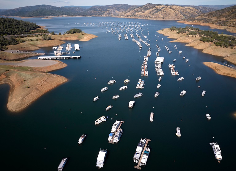
Oroville Dam Citizens Advisory Commission
The California Natural Resources Agency is hosting its 15th Oroville Dam Citizens Advisory Commission meeting on Wednesday, Nov. 15 from 10 a.m. to noon. The public meeting will be held virtually and will include presentations and public comment. The Commission will receive briefings on Forecast Informed Reservoir Operations, the U.S. Army Corps of Engineers’ process to update the Water Control Manual for Oroville operations, and preparations for 2023–24 winter operations. The Citizens Advisory Commission is a forum for questions and feedback from the communities surrounding Oroville Dam. For information on how to join the virtual meeting, please visit the Oroville Dam Citizens Advisory Commission website.
Maintenance Work on Main Spillway Extended
Routine concrete and joint sealant repair work on localized areas of Oroville Dam’s main spillway has been extended to Dec. 1 due to favorable weather and lower reservoir levels. DWR will continue to monitor reservoir levels and weather forecasts closely and will end repair work for this season early if spillway releases are required for flood control.
Oroville Dam’s main spillway performed well and operated as designed in 2023, passing over 2,370,000 acre-feet of water – approximately 67 percent of the capacity of Lake Oroville. Due to seasonal temperature variations, spillway releases, and sun exposure, periodic concrete and joint sealant repairs of the main spillway are expected.
Work so far has included concrete repair, approximately 1,700 feet of concrete slab and wall joint sealant replacement, and inspection of the 51,000 feet of piping that support the spillway’s improved drainage system.
The spillway was rebuilt to the highest engineering and safety standards with oversight and guidance by the Federal Energy Regulatory Commission (FERC), Division of Safety of Dams (DSOD), and an independent board of consultants. DWR performed a significant amount of inspection and testing throughout construction to verify compliance with project specifications. DWR also provides regular updates to the Oroville Dam Citizens Advisory Commission, a public forum for discussing operations, maintenance, and public safety activities at Oroville Dam and its facilities.
Oroville Wildlife Area
The 11,800-acre Oroville Wildlife Area (OWA) is a forested upland and riparian habitat along the Feather River and around the Thermalito Afterbay. Managed by the California Department of Fish and Wildlife, in partnership with DWR, the OWA allows for additional outdoor recreation activities such as hunting, river- and pond-oriented fishing and boating, and wildlife observation and photography.
Several trails cross throughout the OWA, providing opportunities for hiking and biking. Other trails within the OWA are not officially designated and none are ADA accessible. The Feather River runs through the center of the OWA and several locations provide unpaved boat ramp access. Both car-top and trailer launching occur at many of these ramps. A restroom is available at the day use/camping area adjacent to the Thermalito Afterbay River Outlet area.
The OWA is a “Type C” wildlife area (hunting pass not required) and is open for hunting seven days a week with entry hours limited from 1.5 hours before sunrise to one hour after sunset. No rifles or pistols may be used or possessed on the wildlife area except at the designated shooting range (Rabe Rd. Shooting Range off Larkin Rd.; open seven days a week from sunrise to sunset). Lead ammunition cannot be used while hunting in California.
Oroville Recreation
DWR biologists are using the Feather River Fish Monitoring Station to determine abundance, run timing, and origin (hatchery or natural) of steelhead and Chinook salmon populations. This information will improve the management of these important fish populations. Upstream migrating fish totals between Sept. 11 and Oct. 28 are:
- Chinook salmon: 26,494
- Steelhead: 444
DWR, State Parks, and the Department of Fish and Wildlife maintain over 92 miles of trails in the Oroville area. An interactive map of recreation facilities, including open trails and their permitted uses (hike, bike, horse, multi) is available on DWR’s Lake Oroville Recreation webpage. A paper trail map is available at various locations, including most entrance kiosks and the Lake Oroville Visitor Center. The marinas at Bidwell Canyon and Lime Saddle are open daily and provide a variety of services including a convenience store, gas, and boat rentals.
The Lake Oroville Visitor Center is open seven days a week from 9 a.m. to 5 p.m. Staffed by knowledgeable guides, the Visitor Center features interpretive displays on Oroville Dam, area geology, wildlife and habitat, hydroelectric power, and cultural and historical artifacts. View videos in the theater about the construction of Oroville Dam, walk or hike along nearby trails, and visit the 47-foot-tall observation tower that provides unsurpassed panoramic views of surrounding areas. Free guided tours for school and community groups are available by reservation. Parking and admission to the Visitor Center are free.
Current Lake Operations
Lake Oroville is at 817 feet elevation and storage is approximately 2.39 million acre-feet (MAF), which is 68 percent of its total capacity and 133 percent of the historical average.
Feather River flows remain at 650 cubic feet per second (cfs) through the City of Oroville with 1,100 cfs being released from the Thermalito Afterbay River Outlet (Outlet) for a total Feather River release of 1,750 cfs downstream. DWR continues to assess releases to the Feather River daily.
Visitors to Oroville Dam may also notice minor amounts of water flowing from drains built into the emergency spillway, which is normal and expected with the emergency spillway design. The dam and emergency spillway continue to operate as intended.
The public can track precipitation, snow, reservoir levels, and more at the California Data Exchange Center. The Lake Oroville gage station is identified as “ORO.”
All data as of midnight 11/8/2023