Lake Oroville Community Update - August 25, 2023
An aerial view shows high water conditions at Enterprise Bridge on Lake Oroville in Butte County, California. Photo taken July 3, 2023.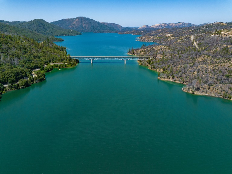
New Hours for Visitor Center
Starting Saturday, August 26, the Lake Oroville Visitor Center will now be open seven days a week from 9 a.m. to 5 p.m. Staffed by knowledgeable guides, the Visitor Center features interpretive displays on Oroville Dam, area geology, wildlife and habitat, hydroelectric power, and cultural and historical artifacts. View videos in the theater about the construction of Oroville Dam, walk or hike along nearby trails, and visit the 47-foot-tall observation tower that provides unsurpassed panoramic views of surrounding areas. Free guided tours for school and community groups are available by reservation.
The Visitor Center also has a new, small library area featuring educational books for children on topics such as nature, the water cycle, science, and engineering. Parents, caregivers, and young children are encouraged to enjoy these books during their visit, with designated seating areas in the lobby or throughout the museum. Parking and admission to the Visitor Center are free.
Explore the Thermalito Afterbay
The Thermalito Afterbay allows more extensive motorized watercraft use than the Thermalito Forebay and has a greater focus on the preservation and enhancement of wildlife habitat areas. With 17 miles of shoreline and 4,300 surface acres of water, the Thermalito Afterbay is open for boating, swimming, fishing, picnicking, and hunting.
The Monument Hill boat ramp and day use area provides a two-lane ramp with a boarding dock, picnic tables, barbecues, restroom facilities, a fish cleaning station, and a swimming beach. The Wilbur Road boat ramp and Larkin Road Car-top boat ramp provide additional launching facilities for water recreation, with vault restroom facilities at both locations.
Located within the Oroville Wildlife Area, campsites near the Afterbay Outlet offer primitive camping facilities with vault restrooms and trash receptacles. The Thermalito Afterbay outlet is one of the most popular river fishing areas, particularly during salmon runs. To check hunting and fishing seasons and regulations, consult the California Department of Fish and Wildlife.
Several trails in the Afterbay area – Toland Road Trailhead, Tres Vias Trailhead, and East Hamilton Road Trailhead – connect with the popular Brad Freeman Trail for further exploration of the Oroville Wildlife Area. The East Hamilton Trailhead is the only facility with a picnic table and a small gravel parking area.
Spend the Day at the Thermalito Forebay
The Thermalito Forebay provides a unique recreation experience compared to other geographic areas of the Lake Oroville State Recreation Area. Its relatively stable water elevation level, proximity to City of Oroville amenities, and developed day use facilities provide an experience that is much different from Lake Oroville.
The North Thermalito Forebay boat ramp and day use area covers roughly half of the Forebay’s 630 surface acres and hosts non-motorized boating with a swim beach, a large picnic area with barbecue grills, and abundant shade trees. This area also has restroom facilities, including showers, and drinking fountains to stay hydrated during a heat wave.
Also, at the North Forebay, the Feather River Center and Forebay Aquatic Center promote education, recreation, boating, water safety, competitive water sports, and tourism. The Aquatic Center offers a wide range of rental equipment, from kayaks and canoes, to hydrobikes and pedal boats, which can be rented by the hour or day.
At the South Thermalito Forebay day use area, a two-lane boat ramp provides power boating access for recreation and fishing. The South Forebay also has a shaded picnic area with barbecue facilities, a sandy swim beach, a vault restroom facility, and a fish cleaning station. The Forebay shoreline also provides swimming opportunities to beat the heat.
Oroville Recreation
Visitors continue to enjoy the abundant recreation facilities at the Lake Oroville State Recreation Area. All major boat ramps are open with numerous launching lanes and available parking. Floating campsites provide a unique on-the-water camping experience, and several regular campgrounds provide camping throughout the Recreation Area while offering close access to water activities. The marinas at Bidwell Canyon and Lime Saddle are open daily and provide a variety of services including a convenience store, gas, and boat rentals.
DWR, State Parks, and the California Department of Fish and Wildlife also maintain over 92 miles of trails in the Oroville area. An interactive map of recreation facilities, including open boat ramps, and their permitted uses (hike, bike, horse, multi) is available on DWR’s Lake Oroville Recreation webpage. A paper trail map is available at various locations, including most entrance kiosks and the Visitor Center.
Current Lake Operations
Lake Oroville is at 860 feet elevation and storage is approximately 2.95 million acre-feet (MAF), which is 83 percent of its total capacity and 139 percent of the historical average.
Feather River releases are currently at 6,000 cubic feet per second (cfs). Flows through the City of Oroville are at 650 cfs and releases from the Thermalito Afterbay Outlet (Outlet) are at 5,350 cfs for a total of 6,000 cfs downstream of the Outlet. Further changes in total releases may occur next week for Delta water quality purposes. DWR continues to assess releases to the Feather River daily.
DWR has been using the main spillway intermittently this summer for water releases to manage storage within the Oroville complex or maintain Feather River temperature levels during ongoing river valve outlet system work near the Hyatt Powerplant. When the main spillway is not in use, water may still be seen on the main spillway outlet as the seals on the eight radial gates are not designed to be watertight. The gate seals do not play a role in the structural integrity of the gates, which continue to operate as intended. DWR periodically maintains and adjusts the seals during low-reservoir conditions to improve their sealing capability. The radial gates were last inspected and tested in Dec. 2022.
Visitors to Oroville Dam may also notice minor amounts of water flowing from drains built into the emergency spillway, which is normal and expected with the emergency spillway design. The dam and emergency spillway continue to operate as intended.
The public can track precipitation, snow, reservoir levels, and more at the California Data Exchange Center. The Lake Oroville gage station is identified as “ORO.”
All data as of midnight 8/24/2023.