Lake Oroville Community Update - May 13, 2022
An aerial drone view of West Branch Feather River Bridge over Lake Oroville in Butte County on May 6, 2022.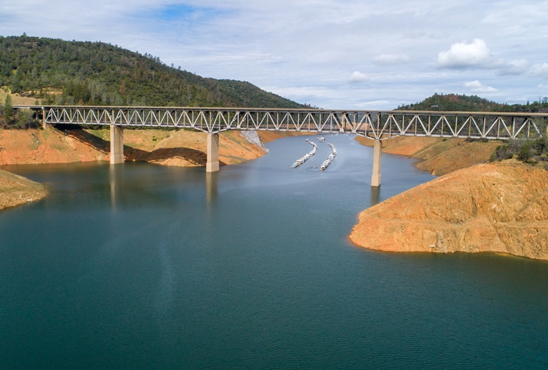
Drought Update
California has experienced the driest January through March on record, leaving the statewide snowpack at 23 percent of average for this date despite the recent late season storms. The main benefit of late season storms will be to prevent soils from drying out early in the season, which can aid runoff efficiency of the remaining snowpack to the state’s reservoirs.
Reservoir levels across California vary depending on their location and source of inflows but all are reflective of the state entering its third year of drought. Locally, record-setting precipitation from the late October 2021 atmospheric river (AR) storm fell mainly in the Feather River (Oroville Dam) and American River (Folsom Dam) watersheds, missing a large part of the Lake Shasta watershed. Lake Oroville currently has more storage than on this date last year and the Department of Water Resources (DWR) is working to preserve as much storage as possible for future needs to maintain Delta water quality, protect endangered species, and meet senior water right obligations.
DWR is also administering a number of grant programs to help mitigate and address drought impacts. One program, the Small Community Drought Relief Program, has already awarded more than $33 million to local counties and cities around Oroville for projects such as water system improvements and connections in Orland, Berry Creek, and Williams and for water hauling in Butte, Glenn, and Colusa counties.
The DWR hydrology team and a California Water Board data specialist held a media briefing with reporters and meteorologists Tuesday to discuss the latest drought data points and where we stand in terms of current conditions. A recording of the briefing is available on the DWR YouTube webpage.
As we enter the warmer months, everyone is encouraged to find ways to save water, because despite current reservoir levels, the state is going to have water challenges later this year. See tips, tools, and ideas on the Save Our Water website. Information about real time local hydrological conditions, forecasts, and water conditions is available on DWR’s new website California Water Watch. Visit DWR’s Drought webpage for the latest information.
Collaborating to Support Salmon
Managing California's water needs during our severe drought means minimizing impacts on our environment while also meeting the health and safety, economic, and agriculture needs of our communities. The DWR and Department of Fish and Wildlife (CDFW) are actively working to respond to drought and climate change impacts posing challenges to our native species and ecosystems, including California’s salmon populations.
Scientists and fish biologists from both DWR and CDFW have a long history of working together and collaborating with federal, state, local, non-governmental, tribal, and academic partners who have joined forces to protect and support California’s salmon populations. Collaborating through shared projects, funding, and research efforts, DWR and CDFW are identifying critical challenges facing salmon and using the best available science and technology to find ways to promote salmon health and survival.
The state has embarked on dozens of projects to ensure the success of California’s salmon population. Some of these projects are highlighted in the recent DWR-CDFW news release. These projects include restoring critical habitat for salmon and other fish species, improving salmon migration corridors to and from the ocean, and increasing our monitoring efforts so we can better track the status of populations and devise new strategies to improve their status. View the latest video on the DWR YouTube channel.
To learn more about collaborative projects protecting our salmon populations, check out the DWR website highlighting these efforts and more. Additional projects will be featured throughout the summer.
Wildfire Preparedness Week Recap
California Governor Gavin Newsom has recently proclaimed May 1 to May 7, 2022, as “Wildfire Preparedness Week”. CAL FIRE held educational events to raise awareness on wildfire preparedness, including fuel reduction and vegetation management projects and ways the public can prepare for wildfire by making your home more fire resistant (home hardening), creating defensible space, and developing a wildfire action plan well ahead of time. Californians are encouraged to join these wildfire preparedness efforts by taking actions now to protect your home and family. Develop your personalized plan by visiting https://plan.readyforwildfire.org/.
DWR continues to prepare for wildfire around the Oroville-Thermalito Complex by implementing fuel reduction projects and creating defensible space around infrastructure and adjacent to residential communities. Through the use of grazing, brush removal, chipping, and controlled burns DWR with area partners including CAL FIRE, California Department of Parks and Recreation (CA Parks), Butte County Fire Safe Council (BCFSC) aim to reduce wildfire risk, increase public safety, and promote forest health. The DWR partnership with BCFSC and goats from Hanski Family Farms recently grazed 35 acres along Oro Dam Blvd. East with the goal of reducing ladder fuels to help lessen the spread of a potential wildfire, protecting infrastructure and nearby communities.
Oroville Recreation
The Spillway Boat Ramp opened on April 29, joining the open Loafer Point, Bidwell Canyon, and Lime Saddle boat ramps. The Foreman Creek and Stringtown cartop boat ramps are also open. Restrooms, potable water, and fish cleaning stations are not in service at the Spillway Boat Ramp area but portable toilets are provided – please plan visits accordingly. Information on current boat ramp status can be found on the California State Parks’ Lake Oroville State Recreation Area webpage. Scroll down to the link for “Current Launch Ramp Status”.
Visitors to Oroville Dam and the Spillway Boat Ramp area will be able to use the newly constructed Lakeside Access Road which descends into the lake inundation zone before travelling back up to the Spillway Boat Ramp parking lot where they can access boat launch lanes, a shaded day use area with picnic tables, and multi-use trails suitable for hikers, bikers, and equestrians. The previous access road through the CHP screening booths and below the Emergency Spillway will only need to be used when lake elevations rise high enough to flood the new Lakeside Access Road.
The Lake Oroville Visitor Center is open to the public on Tuesdays, Wednesdays, and Thursdays from 9 a.m. to 5 p.m. Pick up the Lake Oroville Trails Map, which shows more than 91 miles of trails available to equestrians, bicyclists, and hikers, at Lake Oroville State Recreation Area (LOSRA) kiosks, the Oroville Area Chamber of Commerce, or the Feather River Recreation and Parks District.
Visit the California Parks LOSRA webpage for current information on facility status and campground reservations. An interactive map of recreation facilities in DWR’s Oroville-Thermalito Complex is available on DWR’s Lake Oroville Recreation webpage. Information about the 11,000-acre Oroville Wildlife Area is available on the California Department of Fish and Wildlife webpage.
Current Lake Operations
The elevation of Oroville’s reservoir is about 776 feet elevation and storage is about 1.93 million acre-feet, which is 55 percent of its total capacity and 70 percent of historical average. Lake Oroville likely hit its peak storage for this Water Year on May 8 at 1.94 million acre-feet (MAF), about 400 thousand acre-feet higher than the peak in 2021. Dry and warmer temperatures in the mid-to-upper-80s are forecast over the weekend and into next week.
Average daily inflows this week have been in the range of 3,000 to 4,000 cubic feet per second (cfs) and are expected to be in this range or slightly lower over the coming week. The Feather River releases are at 2,200 cfs to meet downstream Delta water quality and outflow needs. Flow in the low-flow channel through the City of Oroville is 650 cfs and flow through the Thermalito Afterbay Outlet is currently 1,550 cfs. Flows are assessed daily.
The public can track precipitation, snow, reservoir levels, and more at the California Data Exchange Center at www.cdec.water.ca.gov. The Lake Oroville gage station is identified as “ORO”.
All data as of midnight 5/12/2022