Lake Oroville Community Update February 25, 2022
Aerial view of Lake Oroville on January 25, 2022.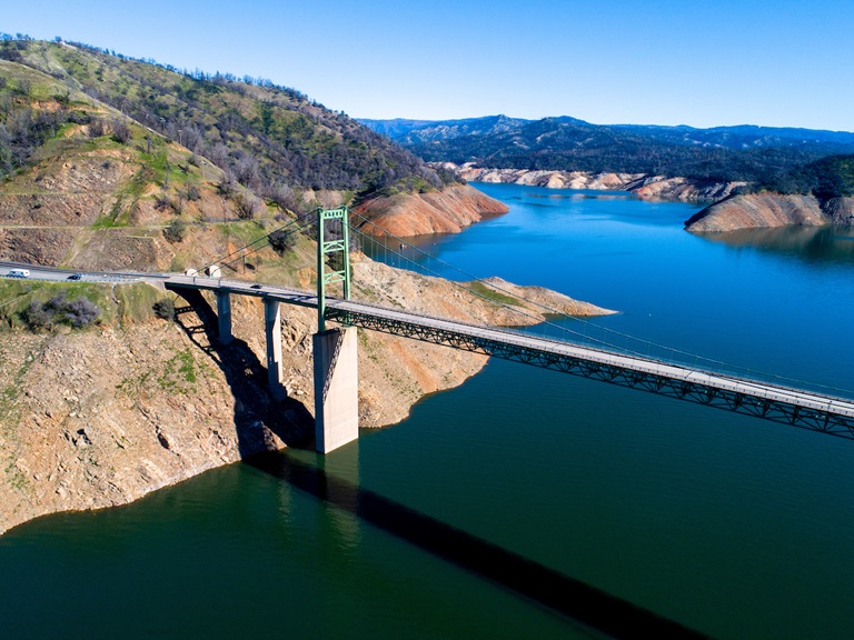
Feather River Hatchery Steelhead Planting
The Feather River Fish Hatchery has raised over 630,700 steelhead for release this year. The steelhead were raised for a full year at the hatchery and averaged about 8 to 9 inches in length. Around 129,300 steelhead were released in the Thermalito Afterbay – plantings occurred in December 2021 and February 2022. This is a significant increase from normal planting years and will contribute to a more productive recreational fishery.
The remaining approximately 501,400 steelhead were released into the Feather River at Boyd’s Pump Boat Launch Feb. 3 to Feb. 18 to meet mitigation requirements. Releasing these young fish further downstream improves their chance of survival. This shortened migration route allows juvenile fish to avoid predators. Steelhead are a salmonid species and are an ocean-going trout. They will migrate from freshwater to marine (ocean), returning to freshwater environments to spawn.
They can spawn several times during their lifetime and can live up to eight years. Their “steelhead” name comes from their appearance, a more streamlined shape than Chinook salmon and with a silvery or brassy color as an adult.
The Feather River Fish Hatchery is a California State Water Project (SWP) facility built in the late 1960s to mitigate impacts on fish migration resulting from the construction of Oroville Dam which prevented access to spawning grounds further upstream. The Department of Water Resources (DWR) maintains the facility and funds the hatchery operations, fish spawning, rearing, and stocking activities provided by California Department of Fish and Wildlife staff.
DWR Survey of Lake Oroville
DWR is conducting a bathymetric (underwater) survey of Lake Oroville to complete a comprehensive topography, or map, of the lakebed. The underwater survey will complement a December 2021 survey that took advantage of the lake’s low water elevations to perform an ‘above water level’ survey of Lake Oroville’s topography, dams, and related structures. Using highly accurate LiDAR remote sensing, the December survey produced precise, three-dimensional information of Lake Oroville’s lakebed.
Similar data will be collected from the bathymetric survey. Data from both surveys will provide DWR with up-to-date information that can be used to determine changes in sedimentation, update the reservoir’s storage-stage relationships, and inform future boat ramp extensions.
DWR Launches California Water Watch
DWR has a new website to better inform Californians about hydrologic conditions, forecasts, and information at the scale of their local watershed. The website, California Water Watch, allows the public to obtain a quick snapshot of local and statewide water conditions and was developed as part of the Governor’s drought emergency proclamation. Information is updated from a variety of data sources and will assist the public to research, learn, and stay informed about California’s most precious resource – water.
The website displays current statewide hydroclimate and water supply conditions, including precipitation, temperature, reservoir storage, groundwater conditions, snowpack, streamflow, soil moisture, and vegetation conditions. Links to information about drought conditions and how water is used in California are also provided.
Oroville Recreation
The Loafer Point, Bidwell Canyon, and Lime Saddle boat ramps are open. The Oroville Dam Spillway boat ramp remains closed for repairs. The Foreman Creek and Stringtown cartop boat ramps are also open.
Intermittent, short duration closures of the Oroville Dam Crest parking lot may occur to accommodate Lakeside Access Road construction activities. The popular walking/bicycling trail across the top of the dam will remain open and parking will continue to be available at the Upper Overlook.
Information on current boat ramp status can be found on the California State Parks’ Lake Oroville State Recreation Area webpage. Scroll down to the link for “Current Launch Ramp Status”.
The Lake Oroville Visitor Center is open to the public on Tuesdays, Wednesdays, and Thursdays from 9 a.m. to 5 p.m. Pick up the Lake Oroville Trails Map, which shows more than 97 miles of trails available to equestrians, bicyclists, and hikers, at Lake Oroville State Recreation Area (LOSRA) kiosks, the Oroville Area Chamber of Commerce, or the Feather River Recreation and Parks District. The Loafer Creek Recreation Area continues to be closed due to waterline repair (boat ramp access allowed).
Visit the California Parks LOSRA webpage for current information on facility status and campground reservations. An interactive map of recreation facilities in DWR’s Oroville-Thermalito Complex is available on DWR’s Lake Oroville Recreation webpage. Information about the 11,000-acre Oroville Wildlife Area is available on the California Department of Fish and Wildlife webpage.
Current Lake Operations
The elevation of Oroville’s reservoir is about 748 feet elevation and storage is about 1.66 million acre-feet, which is 47 percent of its total capacity and 76 percent of historical average. Temperatures over the weekend are forecasted to be in the low 60s to low 40s. Next week’s temperatures are forecasted to range between upper 60’s and low-70s to low or upper-40s at night. A chance of rain is forecasted in the Feather River watershed next week.
The average daily inflows this week have been around 4,000 cubic feet per second (cfs). Inflows through the weekend and next week are forecasted to be around 3,500 cfs to 4,000 cfs. Inflows are subject to change based upon on actual weather conditions.
Total flows to the Feather River are 4,750 cfs. This increase is for downstream water quality and flow requirements. Flow in the low-flow channel through the City of Oroville is 650 cfs and flow through the Thermalito Afterbay Outlet is 4,100 cfs. Releases are assessed daily. The public can track precipitation, snow, reservoir levels, and more at the California Data Exchange Center. The Lake Oroville gage station is identified as “ORO”.
All data as of midnight 2/24/2022