Dayflow
The Dayflow program also estimates the following as daily averages:
- Net flow through the Delta Cross Channel and Georgiana Slough (when measured flow is not available).
- Net flow at Jersey Point (also called QWEST)
- Position of X2, the 2 ppt salinity isohaline.
The Dayflow estimate of Delta outflow is referred to as the “net Delta outflow index” (NDOI) because it does not an account for tidal flows, the fortnight lunar fill-drain cycle of the estuary, or barometric pressure changes. It is a quantity that never actually occurs in real time. Rather, it is an estimate of the net difference between ebbing and flooding tidal flows at Chipps Island (~ + / - 150,000 cfs), aliased to a daily average. Depending on conditions, the actual net Delta outflow for a given day can be much higher or lower than the Dayflow estimate. Dayflow Net Delta Outflow vs Net Delta Outflow Index provides an example comparison of Dayflow output with measured daily average outflow.
View Dayflow data and resources on the CNRA Open Data website.
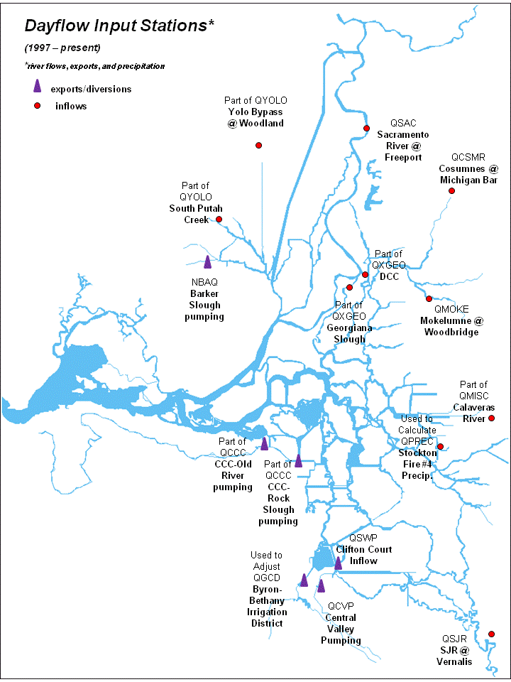
Table 1: Dayflow program: Responsible Agencies And Input Data
|
Responsible Agency |
Input data |
|---|---|
|
USGS |
Sacramento River at Freeport, Yolo Bypass at Woodland, Cosumnes River at Michigan Bar, San Joaquin River at Vernalis, Delta Cross Channel, Georgiana Slough |
|
USACOE |
Calaveras River |
|
EBMUD |
Mokelumne River at Woodbridge |
|
DWR O&M |
Precipitation at Stockton Fire Department, Clifton Court Forebay gate flow, Barker Slough export, Byron Bethany ID depletion, X2 (only when outflow is negative) |
|
DWR Bay-Delta |
Estimated Delta island consumptive use |
|
DWR DPLA |
Sacramento Weir spill, Lisbon Weir flow |
|
USBR |
Delta Cross-Channel gate status, Tracy export, Contra Costa export |
|
SCWD |
Lake Barryessa releases, Lake Solano inflow, Putah Creek |
Resources
Map
Contact Information
Environmental Planning and Information Branch
Dayflow Program
3500 Industrial Blvd.
West Sacramento, CA 95691
(916) 376-9731
Email: Robin.Cheng@water.ca.gov