
National Hydrography Dataset Stewardship Program
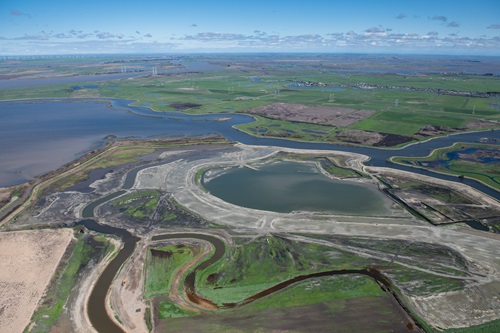
Aerial view at 1500 feet looking north of the Dutch Slough Tidal Marsh Restoration Project the construction site, in the Sacramento-San Joaquin Delta near Oakley, California.
The National Hydrography Dataset (NHD) and Watershed Boundary Dataset (WBD) are used to portray the flow of surface water on The National Map which is maintained by the United States Geological Survey (USGS). The NHD represents the drainage network from headwaters to the ocean with features such as rivers, streams, canals, lakes, ponds, coastline, dams, and stream gages.
The WBD represents drainage basins in eight different sizes. These features are stored in a file geodatabase format for use in a geographic information system. The NHD and WBD are ingredient datasets for NHD Plus High Resolution, a national, geospatial model of the flow of water across the landscape and through the stream network.
Updates
DWR was the steward for NHD and WBD in California until September 2022, when USGS announced that the NHD would become static and resources would be devoted to the transition to the new 3D Hydrography Program (3DHP).
DWR is working with partners to develop and acquire elevation-derived hydrography that will be submitted to USGS for inclusion in the national 3DHP database. It will take several years for the 3DHP to be built out for California. Upon completion, 3DHP data will be easier to maintain, based on a modern data model and architecture, and better meet the requirements of users that were documented in the Hydrography Requirements and Benefits Study (2016).
The NHD for California can no longer be edited by the state stewards. The current generation of national hydrography data is the USGS 3DHP. USGS maintains a 3DHP feature service which is updated quarterly and provides a downloadable dataset that is updated annually.
The NHD’s Watershed Boundaries Dataset is currently the authoritative dataset for California’s watersheds. As the 3DHP data is built out for California, a new set of watersheds based on the elevation-derived hydrography catchments will eventually replace the WBD.
Questions about the NHD, WBD, and 3DHP datasets may be sent to the lead California steward at nhd_stewardship@water.ca.gov.
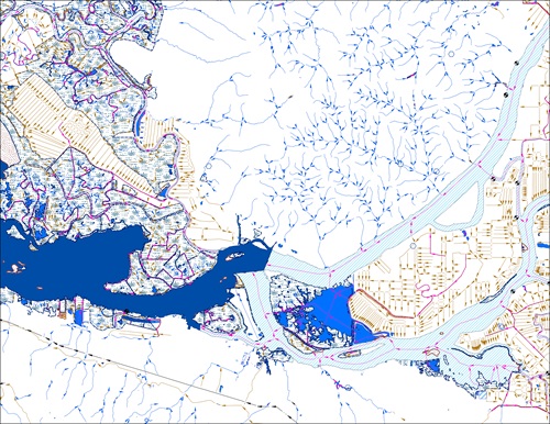
A view of the various water features surrounding the confluence of the Sacramento and San Joaquin Rivers as they flow into Suisun Bay is portrayed here in the National Hydrography Dataset.