
Lake Oroville Update - August 28, 2026
An aerial view shows high water conditions at Oroville Dam located at Lake Oroville in Butte County, California. Photo taken May 6, 2026.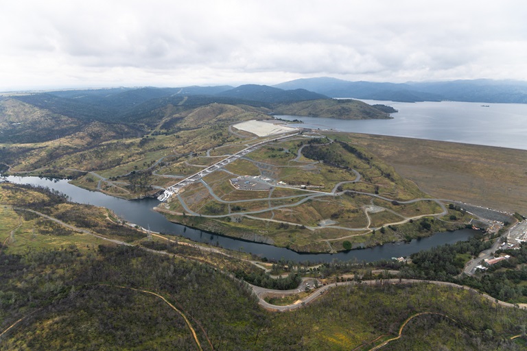
Dam Revegetation Project Ongoing
Construction work is ongoing on a DWR project to reestablish native vegetation in areas adjacent to Oroville Dam’s main and emergency spillways. Work started in June 2026, with the project revegetating approximately 70 acres with seed and replanting six acres of woody vegetation surrounding Oroville Dam’s spillways. The project is designed to improve the appearance of areas near trails and roadways while enhancing the view for visitors and motorists traveling along Oroville Dam Boulevard East.
Maintaininga fire-resilient landscape within the Lake Oroville State Recreation Area was also a top consideration during project development, with planting basins spaced apart to prevent vegetation from acting as a fire ladder. In addition, the selected California-native plants are fire-adapted species that can regenerate after fires.
Members of the public will continue to see construction equipment and grading work in areas surrounding both spillways and along the Diversion Pool. Work in 2026 includes grading and seeding areas of the hillside to establish native grasses, with completion of the first phase expected by November. Project work will continue in 2027, with the establishment of planting basins that include trees and shrubs. A five-year establishment period has been incorporated into revegetation efforts, with temporary irrigation tanks being installed to support initial vegetation growth. Following project completion, Oroville Field Division’s Fuel Load Management Program will maintain native vegetation.
DWR’s revegetation project continues the Department’s commitment to mitigate impacts to native habitats from the 2017 spillway incident. Following the incident, DWR mobilized immediately and implemented a robust reconstruction plan resulting in impacts to native vegetation surrounding the spillways. While project plans were initiated, developed, and submitted during spillway reconstruction efforts, the Federal Regulatory Energy Commission (FERC) gave DWR approval to move forward with revegetation efforts in 2023. Final revegetation plans were approved by FERC in July 2025. Empire Landscaping Inc. of Davis, California, is the contractor for the project.
Lakeside Access Road Now Open
Lake Oroville’s water elevation has lowered enough to allow DWR to reopen the Lakeside Access Road, providing daily access to the Spillway Boat Ramp and Day Use Area around the clock. Construction of the Lakeside Access Road was completed in 2022 and provides a direct route to the Spillway Day Use Area from Oroville Dam Crest Road without requiring visitors to pass through vehicle or watercraft screenings. The screening kiosk is now closed with Lakeside Access Road’s reopening.
Feather River Fish Monitoring Station
DWR resumed operations of the Feather River fish monitoring station on March 4, 2026, to capture the return of spring-run Chinook salmon. Monitoring was temporarily suspended at the end of December 2025 due to anticipated high flows in the Feather River. Upstream migrating fish totals between March 4 and August 23, 2026, are:
- Spring-run Chinook salmon (March 4 through June 30): 8,509
- Fall-run Chinook salmon (July 1 through present): 4,017
- Steelhead: 18
- To see previous year data, visit CalFish.org.
Current Lake Operations
Lake Oroville is at 794 feet elevation and storage is approximately 2.04 million acre-feet (MAF), which is 60 percent of its total capacity and 97 percent of the historical average.
Feather River flows are at 850 cubic feet per second (cfs) through the City of Oroville with releases from the Thermalito Afterbay River Outlet at 7,150 cfs for a total Feather River release of 8,000 cfs downstream. DWR continues to assess Feather River releases daily.
The public can track precipitation, snow, reservoir levels, and more at the California Data Exchange Center. The Lake Oroville gage station is identified as “ORO.”
All data as of 11:59 p.m. on 8/27/2026.