Lake Oroville Update - October 24, 2025
A drone view of water levels at the Oroville Dam located at Lake Oroville in Butte County, California.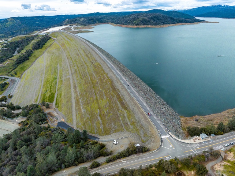
Upcoming Road Closures for Guardrail Work
The Department of Water Resources (DWR) continues work on a $1.9 million paving and sealing project to rehabilitate several locations owned and maintained by the department that are heavily used by maintenance staff and members of the public. Project work is expected to continue through November 2025. Vintage Paving Company, Inc. of Winters, Calif. is the contractor for the project.
Upcoming construction work will require closures to the following public areas and roads:
- Aug. 18 – Oct. 31: Afterbay Dam Crest Road/Brad Freeman Trail south of State Route 162 to the East Hamilton Road Trail Access
- Oct. 27 – Oct. 29: Canyon Drive from the intersection of Oroville Dam Blvd. E./Royal Oaks Drive to Oroville Dam Crest Road will close to vehicles daily from 6:30 a.m. to 6:30 p.m.
- Oct. 30 – Oct. 31: Oroville Dam Boulevard East between Oro Powerhouse Road and the intersection at Canyon Drive/Royal Oaks Drive will close to vehicles daily from 6:30 a.m. to 6:30 p.m.
Additional locations for future paving and sealing work include:
- Thermalito Diversion Dam Powerplant
- Oroville Field Division Operations and Maintenance Center at Glen Drive
DWR will provide more details about scheduled work and potential public access impacts in future newsletters. Work schedules are subject to change based on weather and the availability of equipment and materials.
Key Actions to Prepare for Flooding, Extreme Weather
Climate disasters, from wildfires to frequent floods, have accelerated in recent years - emphasizing the importance of being prepared and planning ahead for extreme weather events. That is why for California Flood Preparedness Week, which runs from October 18 through October 25, DWR is calling on all Californians to understand the risk posed by flooding and how to respond during an emergency.
Flooding can occur throughout the state, from rural to urban areas, in valley and desert communities, in mountain regions, and along the coast. Every California county has received a flood-related emergency declaration in the past 20 years. Flooding can also happen at any time of year and can even occur during drought years.
To prepare for flooding, all Californians should follow three basic steps:
- Be aware of your risk – know whether your home is downslope of a burn area or in a floodplain; pay attention to weather forecasts; listen to local authorities.
- Be prepared – always have an emergency evacuation kit ready; be prepared to evacuate early; have a plan for where you will go in an emergency and what to do with your pets.
- Take action – subscribe to your local emergency providers to get updated information. Visit the National Weather Service webpage to get updated weather information for your community. If local authorities issue an evacuation order, do not delay, follow local guidelines for evacuation and never attempt to drive through a flooded roadway.
For information on how you can prepare your household for flood emergencies, visit https://www.ready.gov/kit.
North Fork Algal Bloom Cleared
An algal bloom in the upper reaches of Lake Oroville in the North Fork arm between Stony Creek and the train tunnel below French Creek has cleared after several weeks of monitoring. Water testing did not detect toxins.
What are signs of algal blooms?
- Small blue-green, green, white, or brown particles in the water
- Streaks in the water that look like spilled paint
- Mats, scum, or foam at the surface or along the shoreline
- Can have an odor described as gasoline, septic, or fishy
Blue-green algae (cyanobacteria) are a natural component of ecosystems. Under certain conditions, including warmer temperatures and increased nutrient loads, algae can grow rapidly causing “blooms.” Algal blooms sometimes produce toxins that can be harmful to people and animals.
DWR environmental scientists routinely monitor for blue-green algae and their toxins within the Oroville-Thermalito Complex. Monitoring occurs during the summer with water samples taken at various locations regularly, which are sent to a lab for toxin analysis. If testing reveals elevated levels of cyanobacteria toxins, DWR staff will work with California’s Regional Water Quality Control Board and recreation area managers to notify the public and post advisory signs at affected waterbodies. To learn more about harmful algal blooms (HAB), or to report a HAB visit the Water Board’s website.
Golden Mussel Inspection Program
DWR is reminding the public that boat ramps at Lake Oroville are no longer open 24/7. Watercraft must be out of the water by ramp closing time or they will be locked into the facility overnight. Please plan ahead. More details about DWR’s mussel inspection program are available at water.ca.gov/mussels.
Watercraft Inspection Location/Decontamination Services
North Thermalito Forebay at Garden Drive and HWY 70 in Oroville
Hours of operation: Daily from 8:30 a.m. to 5:30 p.m.
Starting Nov. 3: Daily from 8:30 a.m. to 4:30 p.m.
Sealed Vessel Launching
Lake Oroville
Ramp hours: Daily from 7:30 a.m. to 6:30 p.m.
- Spillway
Ramp hours: Monday-Thursday 7:30 a.m. to 6:30 p.m.; Friday-Sunday 7:30 a.m. to 8 p.m.
- Bidwell Canyon
Ramp hours: Monday-Thursday 5 a.m. to 6:30 p.m.; Friday-Sunday 5 a.m. to 8 p.m.
- Lime Saddle
Ramp hours: Daily from 5 a.m. to 6:30 p.m.
- Loafer Creek/Loafer Point
Thermalito Afterbay
Ramp hours: Daily from 1.5 hours before sunrise to 1 hour after sunset
- Monument Hill
Thermalito Forebay
Ramp Hours: Daily from 8 a.m. to sunset
- North Forebay (Non-motorized vessels only)
Feather River Fish Monitoring Station
Between Jan. 30 and April 20, high flows in the Feather River required the temporary removal of fish monitoring equipment resulting in lower spring-run estimates. Upstream migrating fish totals through the Feather River Fish Monitoring Station between Jan. 1 and Oct. 19, 2025 are:
- Spring-run Chinook salmon (April 16 through June 30): 17,713
- Fall-run Chinook salmon (July 1 through present): 29,254
- Steelhead: 817
- To see previous year data, visit CalFish.org.
Current Lake Operations
Lake Oroville is at 778 feet elevation and storage is approximately 1.86 million acre-feet (MAF), which is 54 percent of its total capacity and 102 percent of the historical average.
Feather River flows are at 650 cubic feet per second (cfs) through the City of Oroville with 1,800 cfs being released from the Thermalito Afterbay River Outlet (Outlet) for a total Feather River release of 2,450 cfs downstream. DWR continues to assess Feather River releases daily.
The public can track precipitation, snow, reservoir levels, and more at the California Data Exchange Center. The Lake Oroville gage station is identified as “ORO.”
All data as of 11:59 p.m. on 10/23/2025.