Lake Oroville Community Update - March 19, 2021
Walkers on Oroville Dam Crest Road. 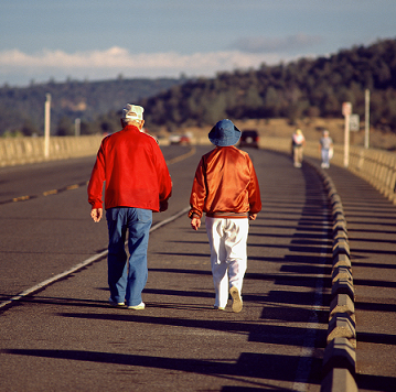
Trail Closure at Loafer Creek
A one-mile portion of the Roy Rogers Trail in the Loafer Creek Recreation Area will be closed Monday through Friday starting March 22 and extending to April 30. The four-mile equestrian and hiking trail will be fully open Saturdays and Sundays only.
The Department of Water Resources (DWR) and California State Parks (CA Parks) are partnering with CAL FIRE’s Vegetation Management Program to clear hazard trees and fire-prone underbrush from the North Complex Wildfire burn scar in the Loafer Creek Recreation Area. CAL FIRE work crews will hand cut and use heavy equipment in the northeastern portion of Loafer Creek; crews may be visible or audible to visitors in the Recreation Area.
This collaborative effort to aid in recovery from impacts caused by the 2020 North Complex wildfire will continue for the next several years.
Temporary Closure of Brad Freeman Trail
A small section of the Brad Freeman Trail near the Thermalito Diversion Pool across from Oroville Dam’s main spillway will be closed Monday, March 22 through Thursday, March 25 for electrical work. Signage directing trail users to a temporary trail around the closure have been installed.
Campground Area Closure Protects Eaglet
A section of the Wyandotte Campground in the Plumas National Forest is temporarily closed to protect a bald eagle nesting territory in the vicinity of Little Grass Valley Reservoir northeast of Oroville. The remainder of the campground is not affected by the closure which is in effect until July 15, 2021.
The closure has been in effect for almost two decades and has helped a bald eagle pair to successfully nest and raise young, contributing to the sustained recovery for this species. Bald eagles are particularly sensitive to disturbances during their nesting phase.
Information about the closure may be found on the U.S. Forest Service website at https://www.fs.usda.gov/alerts/plumas/alerts-notices
Monument Hill Facility
Improvements at the Monument Hill Day Use Area’s boat ramp and beach have been completed. The Department of Water Resources (DWR) placed 45 cubic yards of sand on the public beach, repaired storm erosion, and corrected movement of the boarding float at the boat launch. The Monument Hill facility on the Thermalito Afterbay is off Highway 162 near State Route 99.
The Thermalito Afterbay, part of the Department’s Oroville-Thermalito Complex, is a large water supply and hydropower generation reservoir in the Oroville Wildlife Area (OWA). The California Department of Fish and Wildlife (CDFW) manages the wildlife resources of the OWA for DWR.
Oroville Recreation
The Lake Oroville State Recreation Area (LOSRA) campgrounds at Bidwell Canyon, Loafer Creek (including the Equestrian Campground), and the Lime Saddle Campground are open. Group camping, including floating campgrounds, and boat-in campgrounds remain closed. Reservation capability does not open until April and camping sites will be allocated on a ‘first come-first serve’ basis.
The Lime Saddle, Bidwell Canyon, and Spillway boat ramps are open for use. Bidwell Canyon and Lime Saddle boat ramps are open 24-hours per day and the Spillway boat ramp is open from 6 a.m. to 8 p.m. daily. The Loafer Creek boat ramps remain out of the water. The Loafer Point Boat Ramp area is still closed for construction which is anticipated to be completed this spring. All day use facilities at Lake Oroville State Recreation Area (LOSRA) are open. The Lake Oroville Visitor Center remains closed.
Visit the California Parks LOSRA webpage for current information on facility status as well as current requirements to protect public health during the COVID-19 pandemic. Information about recreation facilities can be found in DWR’s interactive map on the Lake Oroville Recreation webpage. For information about the Oroville Wildlife Area, including the Thermalito Afterbay, visit the California Department of Fish and Wildlife webpage.
Current Lake Operations
The elevation of Oroville’s reservoir is about 716 feet elevation and storage is about 1.38 million acre-feet -- 39 percent full and 53 percent of historical average. Currently, in the Northern Sierra Basin, rainfall is below average, at 54 percent of normal for this time of year and snowpack is also below average at 68 percent of normal. Dry conditions are forecasted for the weekend and into the week of March 22.
The total releases to the Feather River are 1,050 cubic feet per second (cfs) to conserve storage in Lake Oroville. The Feather River flows will consist of 800 cfs down the Low Flow Channel through the City of Oroville, and 250 cfs from the Thermalito Afterbay Outlet (Outlet) for a total of 1,050 cfs for the Feather River’s high flow channel downstream of the Outlet.
The public can track precipitation, snow, reservoir levels, and more at the California Data Exchange Center at www.cdec.water.ca.gov. Lake Oroville is identified as “ORO”.
All data as of midnight 3/18/2021