The Power of Modeling: Preparing for the Future with Data from the Past
Aerial view of the Sacramento-San Joaquin River Delta. DWR/2019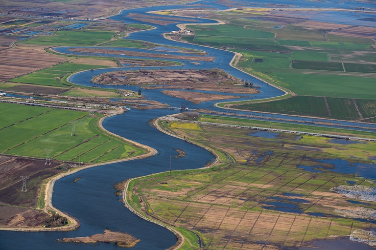
Computer models are in use every day, all around us. Car makers use them to test the safety of vehicles, meteorologists use them to predict the weather, and marketing professionals use them to analyze connections between people and products.
Rooted in math and science and computer programming, models are also an important tool in water management, allowing the Department of Water Resources (DWR) staff to make informed decisions about water operations for people, farms, and the environment.
Models offer the ability to ask "what if" questions about complex water systems that cannot be easily tested in the real world, and they allow water managers to make estimations of possible future conditions based on historical data. The essential information generated by computer models helps DWR make science-based decisions to sustainably manage California’s natural resources.
“Models are used to provide important, necessary information to a process. We need to know if changes to California water will result in an improvement overall, or potential negative impacts to users or the environment,” said Tara Smith, chief of DWR’s Modeling Support Branch. “The power of modeling offers invaluable insights into the world of water and the environment.”
DWR uses state-of-the-art computer models for a variety of purposes, such as studying how water flows; analyzing flood risk; developing habitats for endangered species; analyzing economic impacts; and evaluating water quality impacts in rivers and groundwater basins; and assessing current and future operations of the State Water Project.
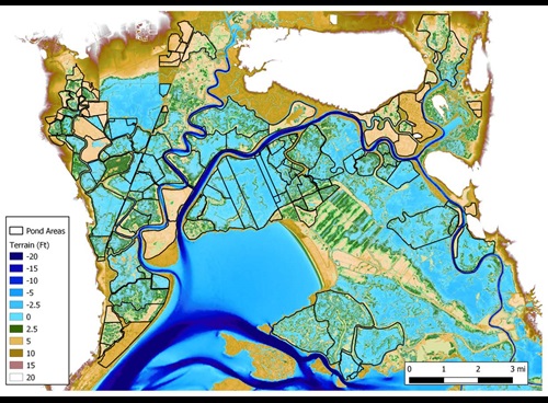
For example, Bay-Delta SCHISM is an open source computer model simulating three dimensional water flow and water quality in the San Francisco Bay Delta estuary. It has been used to study a wide range of physical and biological processes in the Bay-Delta, such as saltwater intrusion, temporary barrier operations, flood inundation, sediment transport, and fish migration.
Models are advantageous because they help determine how proposed actions or choices in one area will affect other areas. Essentially, they make it possible to foresee what will possibly happen without it actually happening.
“One of the most interesting things about models is their ability to run what-if scenarios,” said Erik Reyes, chief of DWR’s Central Valley Modeling Section. “We can take ideas and test our hypotheses to help the State without the expense or impact of a physical pilot project.”
DWR develops and maintains several computer models and analytical tools that are available to everyone at no cost.
“DWR offers models for free to the public for the purposes of transparency and collaboration,” Reyes said. “It’s a part of our duty to offer technical assistance and provide tools to others so they can use them to answer questions they may have.”
DWR, in coordination with the California Water and Environmental Modeling Forum, also hosts a Delta Modeling User Group and an Integrated Water Flow Modeling User Group. These groups promote the exchange of ideas, information, and issues involving the use of Delta models and membership is open to anyone who is interested in participating.
Visit DWR’s modeling page for more information on DWR models.