Living With Earthquakes: How DWR Maintains Vigilance and Resources to Respond to the Next Jolt
Rock is loaded onto barges at the California Department of Water Resources Weber Rock Yard near the Port of Stockton, California. DWR maintains massive stockpiles of rock and flood fighting materials that can be distributed throughout the state to repair potential levee breaches that could occur in a major earthquake. Photo taken June 9, 2021.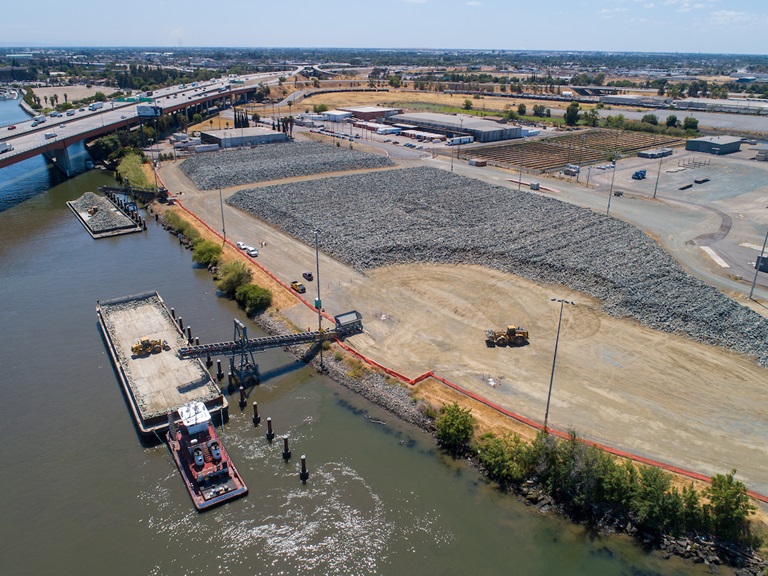
When a magnitude 4.2 earthquake struck near Isleton in the Sacramento-San Joaquin River Delta on October 18, it was a reminder of the threat posed to critical State Water Project (SWP) infrastructure by seismic activity. That infrastructure includes more than 1,100 miles of Delta levees which, if they were to fail during an earthquake, could cause a possible outage in water supply delivery to 27 million Californians and 750,000 acres of farmland.
The temblor was followed by a 2.8 magnitude aftershock and, five days later, a 2.9 magnitude aftershock rumbled below Twitchell Island, less than a mile south of the first quake. All three quakes occurred on the Midland fault, one of several active fault lines that traverse the Delta. The initial jolt was strong enough to trigger a ShakeAlert, the Earthquake Early Warning System managed by the U.S. Geological Survey.
The Richter magnitude scale used by ShakeAlert is the most widely known way of measuring the energy released by an earthquake, while at DWR facilities, response is triggered by another measurement called Peak Ground Acceleration (PGA). PGA measures the maximum ground acceleration at a specific location, which is essential when assessing the risk to structures on the surface. If seismic shaking is felt or reaches a certain PGA measurement at the facility, several inspection procedures are immediately initiated.
“DWR has been planning for and strategizing how to address the earthquake risk and potential disruption to California’s water supply and has developed detailed plans to guide response and recovery efforts. We constantly monitor seismic activity with a network of state-of-the-art equipment which provides real-time information about the location and intensity of earthquakes and also provides information used to estimate the potential for damage to critical infrastructure,” said John Paasch, Deputy Director, Security and Emergency Management Program.
Many of the SWP’s dams, pumping plants, powerplants, aqueducts, tunnels, and pipelines are located in parts of the state that are susceptible to major seismic events. During an earthquake, the field division that maintains the facilities conducts damage and visual inspection and the results are reported to the Area Control Center that provides information to the SWP Operations Center. Although inspections vary for each facility, they may consist of checking for slumps, cracks, unusual seepage or alignment distortions.
The response levels for seismic events depend on the severity and potential for damage. The Isleton earthquake’s epicenter was about 14 miles from the closest SWP pumping plant. After the earthquake was felt, Delta Field Division employees inspected SWP facilities along portions of the North Bay Aqueduct, South Bay Aqueduct, and California Aqueduct and found no damage.
The Division of Flood Management operates the State-Federal Flood Operations Center (FOC) with the National Weather Service and California-Nevada River Forecast Center. Following an earthquake, Local Maintaining Agencies responsible for inspecting their levees report what they find to their county office of emergency services and the FOC; and if local agencies need additional resources to respond to an emergency, the FOC can supplement local supplies of sandbags and other material from state stockpiles. The FOC can also provide local agencies with hydrologic modeling and can deploy Flood Fight Specialists with special training on how to reinforce a levee and direct California Conservation Corps crews in emergency measures. The Division of Flood Management has also developed unique emergency management plans for flooding emergencies in the Sacramento-San Joaquin Delta that take into account potential impacts to this region’s levees from liquefaction and settlement that can be triggered by an earthquake.
The Division of Safety of Dams (DSOD) actively monitors earthquakes across the state and stays in close communication with dam owners to ensure post-earthquake inspections report any problems or concerns. DSOD staff inspects every significant-hazard and high-hazard dam under its jurisdiction at least once a year. DSOD also reviews and approves inundation maps submitted by dam owners, who are also required to submit emergency action plans to the California Office of Emergency Services that would be used in the event of a major earthquake.
According to the United States Geological Survey (USGS), there is a 72 percent chance of a 6.7 or greater magnitude earthquake occurring in the Bay Area by 2043. Said Paasch, “Our priority is the safety and security of the general public and all emergency responders, and we are also responsible for protecting life and property in the event of a major earthquake.”
The proposed Delta Conveyance Project, by adding an earthquake resilient tunnel and intakes in the northern Delta, will provide some insurance against water supply disruption from earthquakes in the Bay Area and Delta. For more on how the Delta Conveyance Project would provide earthquake resilience to the State Water Project, watch Episode 5 in the Delta Conveyance Project Quick Question video series.